The sources disagree
Drawings, field observations, surveys, and operational systems can each describe a different version of the network.

UTILITIES
Connect current and historical drawings, field evidence, surveys, GIS, and asset records into validated operational data for electric, gas, water, and wastewater workflows.
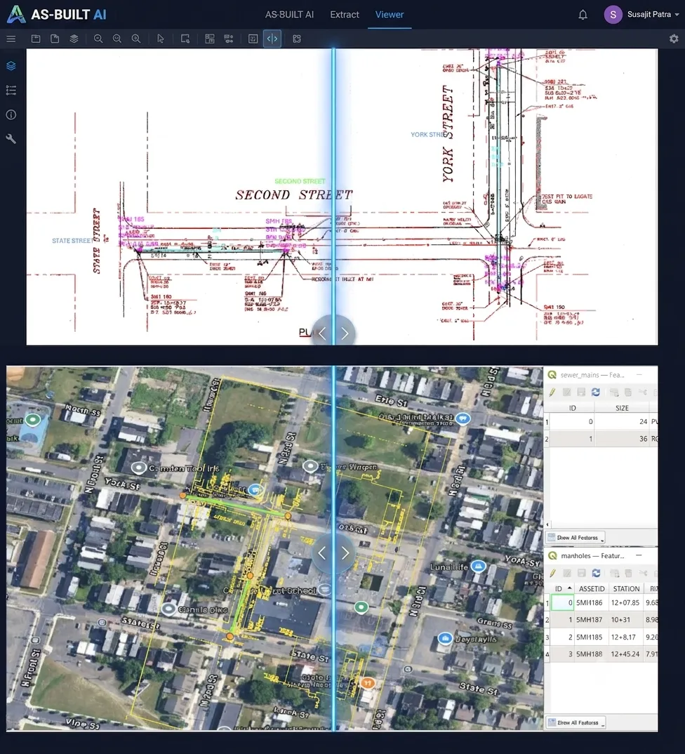
Validated assets, geometry, connectivity, and source evidence for operational systems
THE INDUSTRY PROBLEM
Drawings, field observations, surveys, and operational systems can each describe a different version of the network.
Utility data is not just a list of assets; geometry, connectivity, associations, and source context determine whether it is usable.
Conflicts, uncertain detections, and network anomalies need a technical validation path before acceptance.
WHERE IT CREATES VALUE
Create structured operational data from current and historical engineering information that never entered the system of record.
Compare design, construction, and field evidence before updates are accepted into operational systems.
Identify gaps and conflicts between existing network records and the evidence available today.
WHO IT SERVES
Electric, gas, water, and wastewater utilities
WHAT GOES IN. WHAT COMES OUT.
WHERE TO START
Start with the source material and the operational result, then scope privacy, review, and deployment through Trust & Privacy.
Construction drawings → GIS-ready data
Explore Infrastructure IntelligenceSource evidence, confidence, review, privacy treatment, and engagement-defined deployment controls.
Explore Trust & PrivacyGET IN TOUCH
Bring a representative source sample and describe the operational record, decision, or workflow it must support.
Discuss your utility records