Ingest
Bring together the available images, video, audio, documents, scans, records, and spatial sources.

A CONTEXTFORMERS™ SOLUTION
Construction drawings, blueprints, and field records → GIS-ready data
Ingest decades of construction drawings, blueprints, photos, and drone footage. AI detects utility assets — poles, transformers, valves, manholes, conduit, hydrants, meters, and more — across electric, gas, water, wastewater, and telecom systems.
THE ENGINE
The same five steps run underneath every application. What changes between them is the source material and the output schema, not the intelligence in between.
Bring together the available images, video, audio, documents, scans, records, and spatial sources.
Detect, read, and locate the people, assets, text, geometry, events, and signals that matter.
Connect extracted signals to the customer's people, assets, places, terminology, relationships, and source evidence.
Retain confidence, compare evidence, apply privacy treatment, and route important results through human review.
Return accepted output to search, GIS, asset systems, APIs, and the workflows already in use.
Trust runs through every step: privacy, governance, provenance, confidence, and human review.
HOW IT WORKS
Prioritize representative drawings with clear symbols, readable text, and known geographic context to build a robust AI baseline across plan types.
Your team encodes your symbology and standards — the model inherits your conventions. GIS analysts annotate ingested documents, identifying asset types, geometry, and network connectivity. Utilities have wildly nonstandard legacy symbol sets; this step ensures the model learns yours, not a generic one.
The system runs inference on new documents, detecting objects and geometry in real-time. Extracted assets are automatically converted into feature layers with attributes and confidence scores, structured for Esri Utility Network or Geometric Network migration.
A geocoding engine transforms local plan-sheet coordinates into real-world GIS positions using street names, intersections, parcel references, and known control points. Sub-meter alignment verified against survey-grade benchmarks.
Exhaustive validation across the entire extraction — not spot-checking. Flags dangling laterals, orphaned assets, false loops in radial networks, connectivity gaps, and nodes contradicting source GIS. Determines whether extracted data is actually migration-ready for active utility operations.
Cross-references detected features against satellite and street-level imagery to confirm existence and location. Flags mismatches for manual engineering review. Final confirmation of field conditions versus records.
TIMELINE
Manual digitization of the same archive scope takes 3-6 months of engineering time.
Ingestion and quality assessment
Calibrate pre-trained models to your symbology and standards — models trained across thousands of sheets spanning water, wastewater, and telecom plan types
Inference across the full archive using existing detection models and data schemas
Network validation and connectivity tracing, anomaly resolution, engineering review
INFRASTRUCTURE INTELLIGENCE DEMO
Infrastructure data creation from legacy drawings — demonstrated on the ContextFormers platform.
SEE IT IN ACTION
Infrastructure Intelligence covers two distinct workflows. Each result stays connected to the drawing, map, or field imagery behind it.
UTILITY NETWORKS
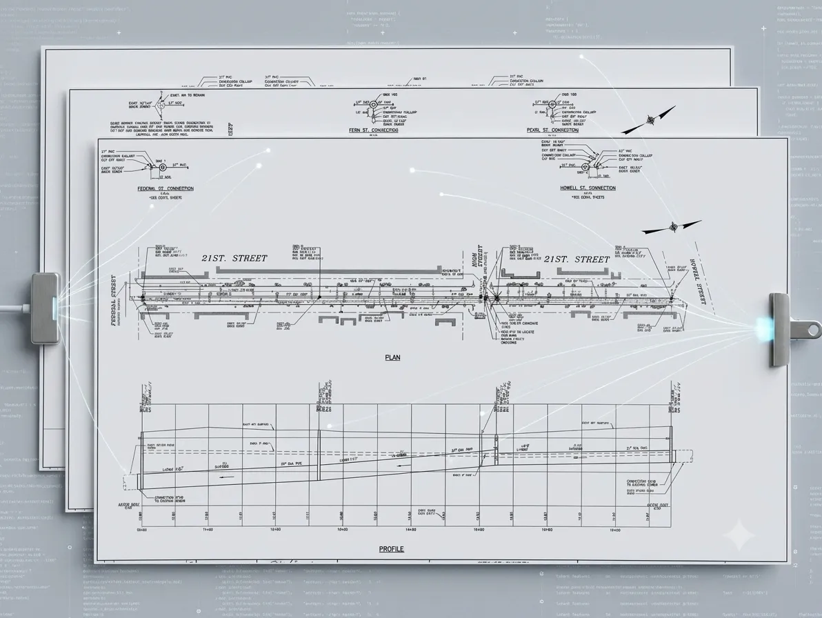
Legacy engineering drawings — the raw input before AI extraction begins.
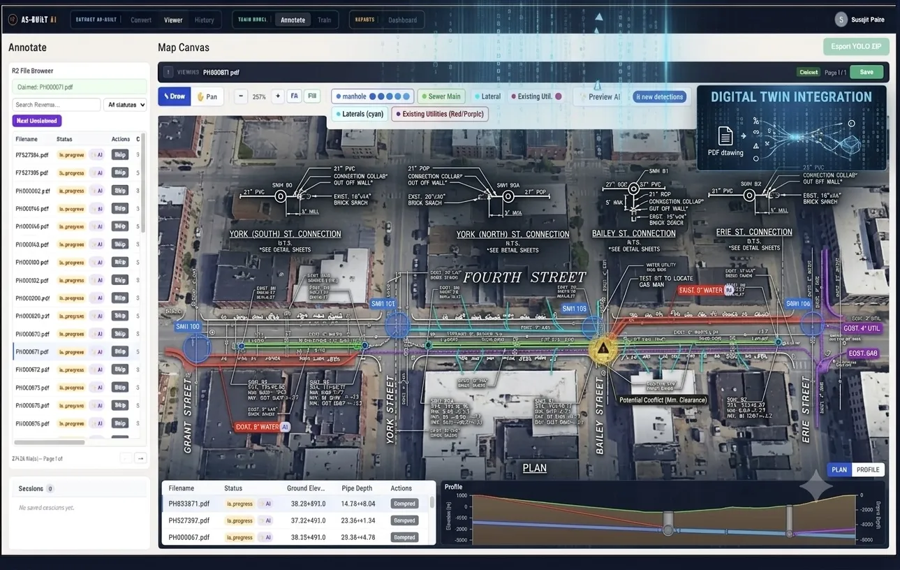
AI-detected manholes, sewer mains, and laterals overlaid on satellite imagery.
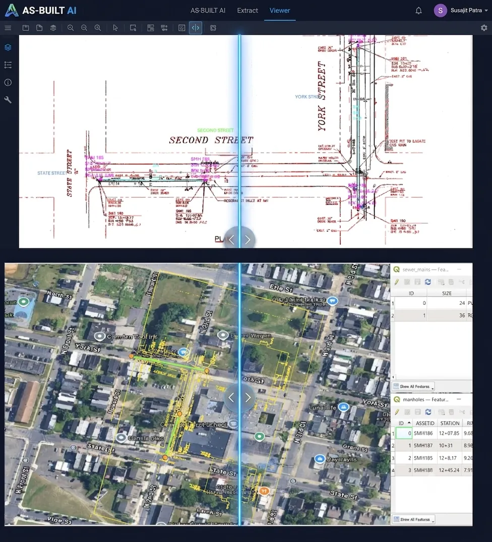
Drawing coordinates mapped to real-world positions with extracted asset attributes.
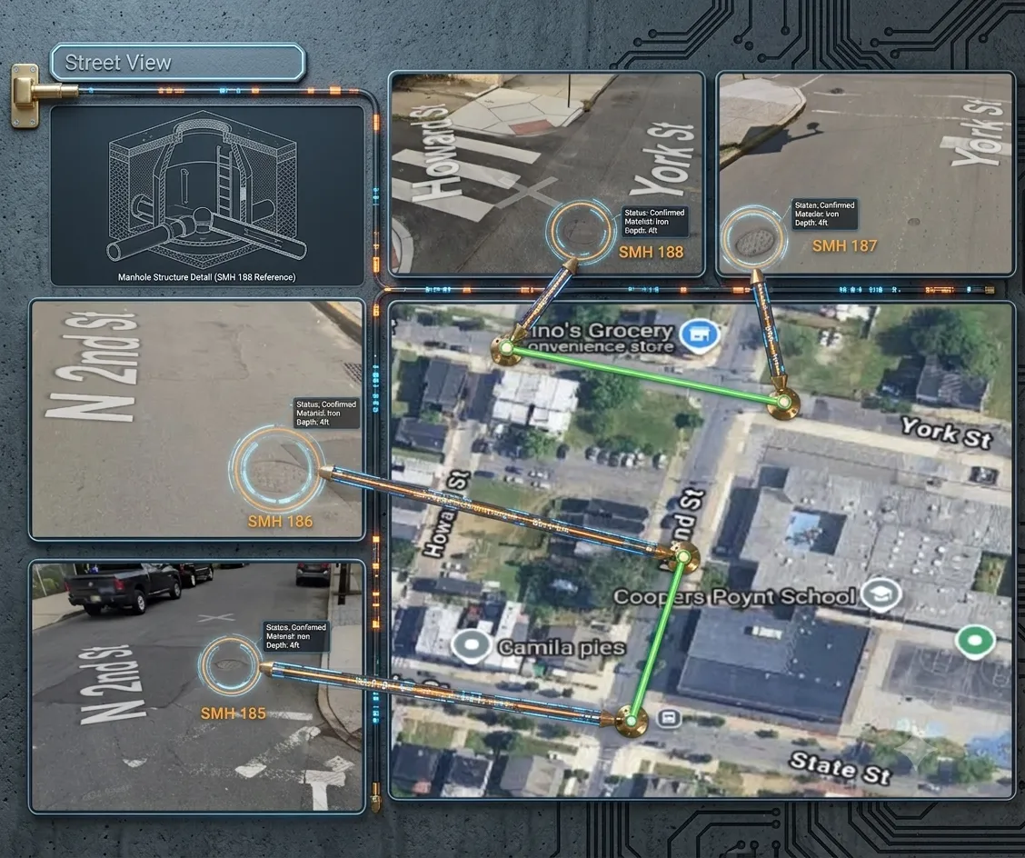
Confirmed manholes mapped to satellite positions with material and depth attributes.
TELECOM INFRASTRUCTURE
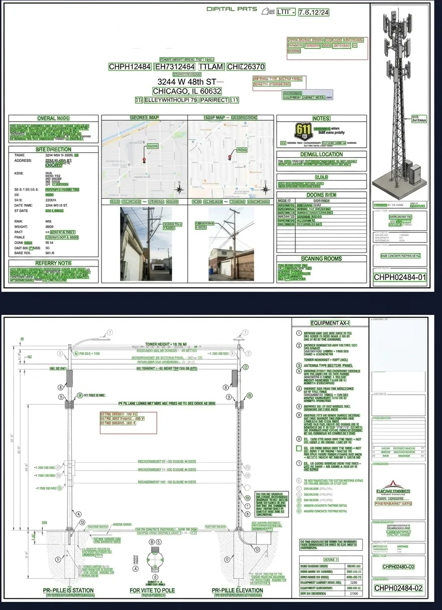
Tower elevation, antenna configuration, and equipment layout from construction drawings.
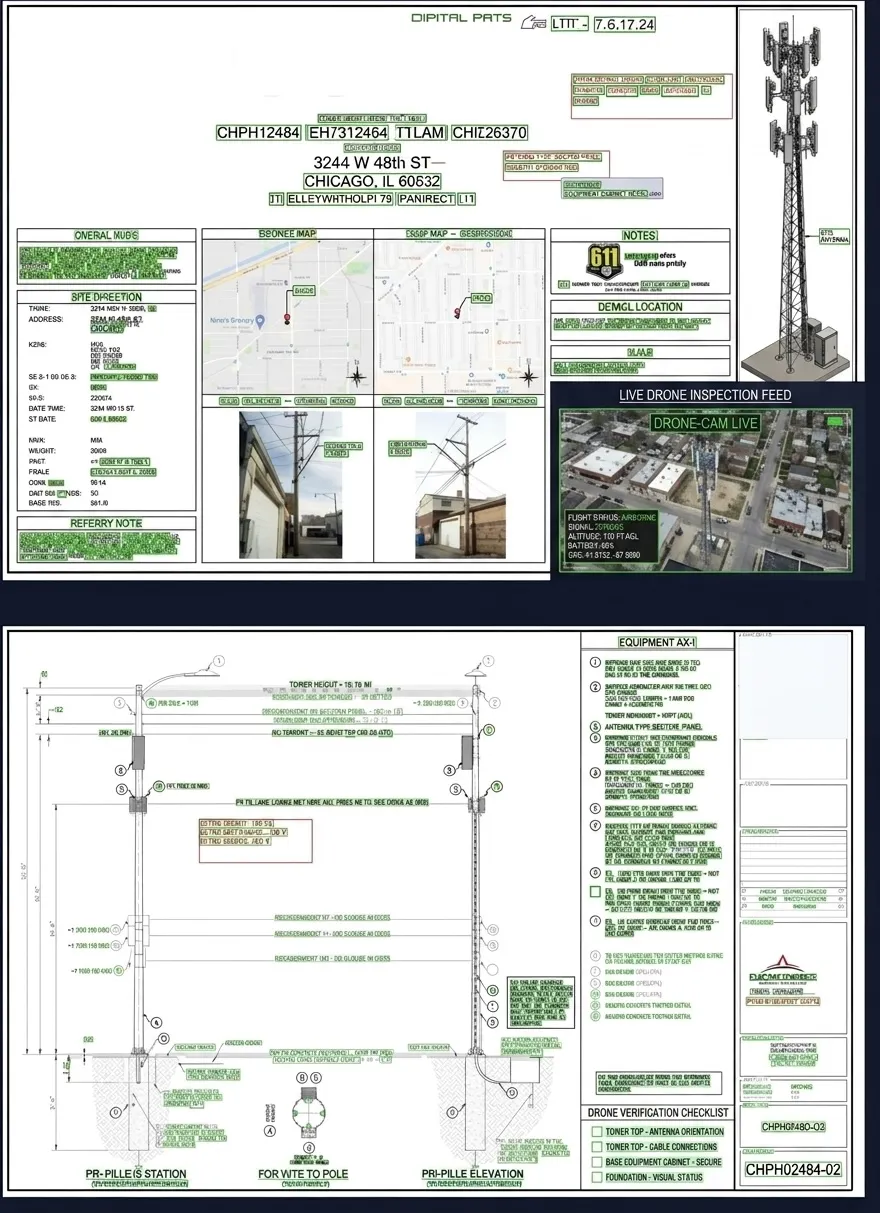
Live drone footage cross-referenced with construction drawings for tower verification and compliance.
SECTORS IT RUNS IN
Each sector page lists the roles it is built for and what they use it on.
WHO IT'S FOR
Electric, gas, water, and wastewater utilities
Fiber, broadband, and telecom operators
Municipal, county, and state agencies
INPUTS & OUTPUTS
PRIMARY INPUTS
SYSTEM OUTPUTS
ContextFormers runs on shared cloud, dedicated single-tenant, or your own infrastructure — including air-gapped deployment — with tenant isolation and automated PII redaction across every model. Trust & Compliance details
OTHER APPLICATIONS
GET STARTED
Tell us about your archive — drawing types, volume, and target GIS platform. We'll scope a project and show you what ContextFormers delivers.
hello@contextformers.com