Ingest
Bring together the available images, video, audio, documents, scans, records, and spatial sources.

A CONTEXTFORMERS™ SOLUTION
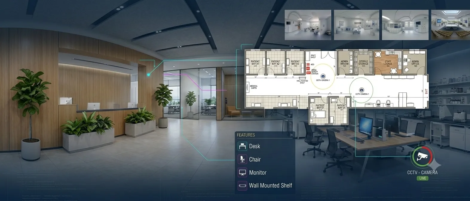
360° indoor scans → validated, spatially linked asset records
Capture 360° panoramas with simultaneous LiDAR scanning. Multi-view AI detects safety equipment, signage, and medical assets at any camera angle. Available depth and LiDAR data connects detections to X, Y, Z coordinates on the floor plan. Auto-generate ArcGIS Indoors feature layers.
THE ENGINE
The same five steps run underneath every application. What changes between them is the source material and the output schema, not the intelligence in between.
Bring together the available images, video, audio, documents, scans, records, and spatial sources.
Detect, read, and locate the people, assets, text, geometry, events, and signals that matter.
Connect extracted signals to the customer's people, assets, places, terminology, relationships, and source evidence.
Retain confidence, compare evidence, apply privacy treatment, and route important results through human review.
Return accepted output to search, GIS, asset systems, APIs, and the workflows already in use.
Trust runs through every step: privacy, governance, provenance, confidence, and human review.
HOW IT WORKS
3-point panoramic capture with simultaneous LiDAR scanning. Every room, corridor, and space captured in high-resolution 360° imagery paired with depth data.
Perspective-invariant recognition identifies critical assets — fire extinguishers, AEDs, exit signs, medication cabinets — regardless of camera position or panoramic distortion.
OCR reads room numbers, cabinet IDs, warning signs, biohazard labels, and equipment tags. Contextual awareness differentiates generic furniture from high-value medical assets.
Object recognition identifies the "what." Logical fusion confirms through spatial reasoning. Text context identifies the "label." Result: high-confidence asset categorization for GIS databases.
Correlates pixel coordinates from the 360° image with LiDAR distance values to calculate exact X, Y, Z coordinates. Geo-locates assets on the floor plan automatically. Measures ADA compliance — door widths, sign heights.
Every detected object is converted into a geospatial feature with rich attribution — asset type, confidence score, room assignment, floor level — ready for ArcGIS Indoors and any indoor GIS system.
DEPLOYED IN PRODUCTION
ContextFormers Facility Intelligence is licensed to geoConvergence — an Esri Gold Business Partner and 20-year Cornerstone Partner — and deployed within their Scan2Twin pipeline into ArcGIS Indoors, under a signed teaming, joint development, and licensing agreement.
FACILITY INTELLIGENCE DEMO
360° facility scanning with AI-powered asset detection, LiDAR fusion, and automated floor plan mapping — demonstrated on the ContextFormers platform.
SEE IT IN ACTION
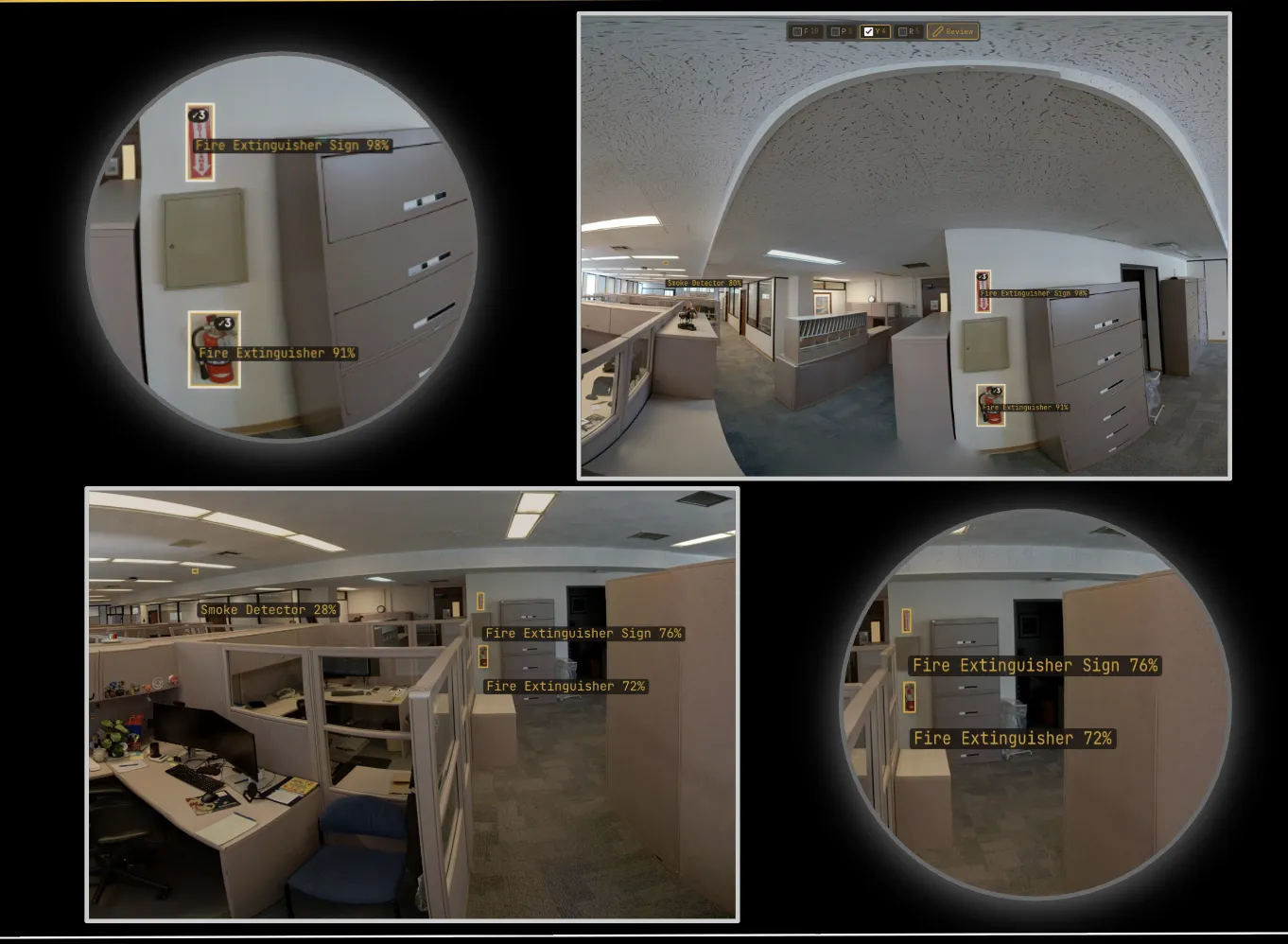
Fire extinguishers detected at multiple angles with confidence scores (72%–98%).
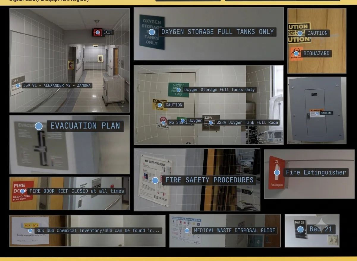
Room numbers, safety signs, medication labels, evacuation plans, and biohazard markers.
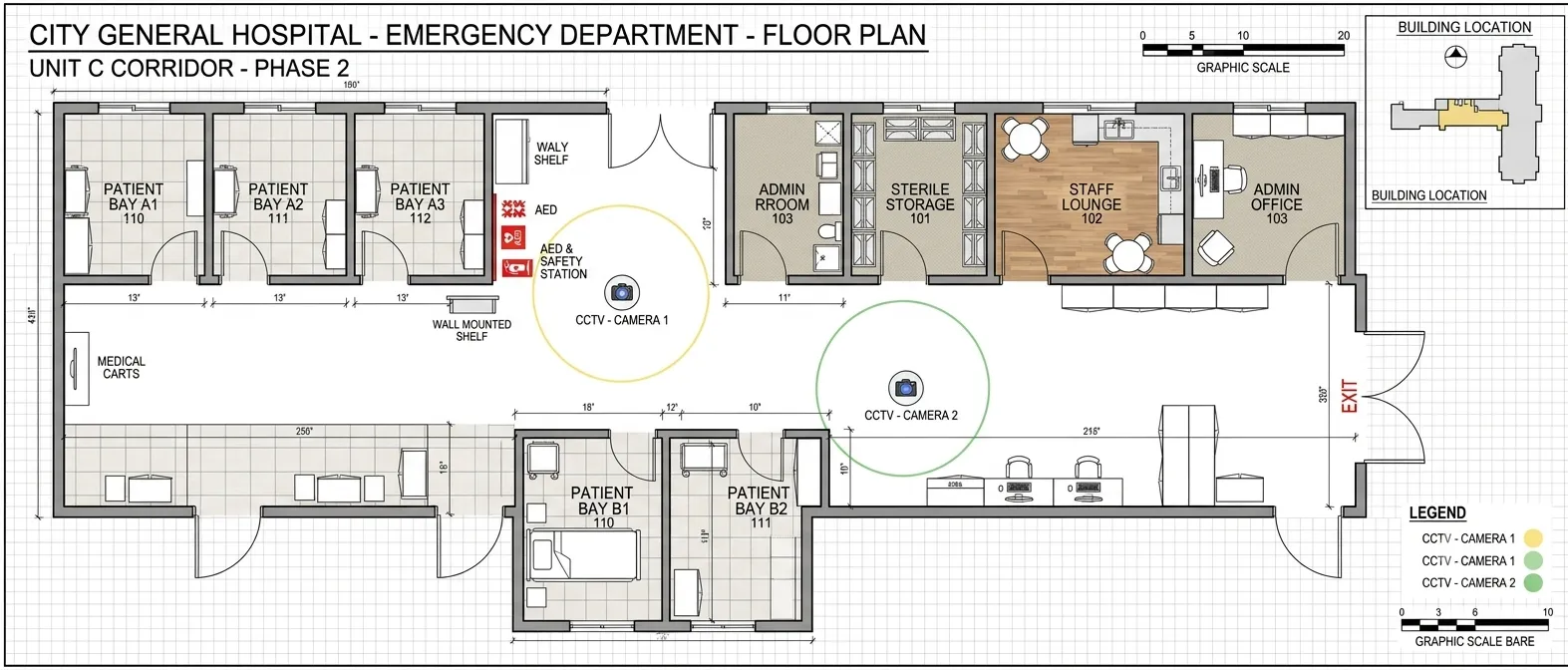
Detected assets mapped to precise floor plan positions with AED stations, camera zones, and room assignments.
SECTORS IT RUNS IN
Each sector page lists the roles it is built for and what they use it on.
WHO IT'S FOR
Hospital systems, medical centers, outpatient facilities
Corporate campuses, data centers, manufacturing facilities
Government buildings, universities, commercial real estate
INPUTS & OUTPUTS
PRIMARY INPUTS
SYSTEM OUTPUTS
ContextFormers runs on shared cloud, dedicated single-tenant, or your own infrastructure — including air-gapped deployment — with tenant isolation and automated PII redaction across every model. Trust & Compliance details
OTHER APPLICATIONS
GET STARTED
Tell us about your facility — building type, floor count, and asset tracking needs. We'll scope a project and show you what ContextFormers delivers.
hello@contextformers.com